Great Britain
Great Britain is an island in the North Atlantic Ocean, off the north-west coast of continental Europe. It covers 209,331 km2 (80,823 sq mi), which makes it the largest of the British Isles, the largest European island, and the ninth-largest island in the world. The island has a maritime climate, which means the temperatures change only a little from one season to the next. To the west is the island of Ireland, which is about 40 per cent the size of Great Britain. Together with over 1,000 smaller surrounding islands and named substantial rocks, these islands make up the British Isles archipelago.
The name "Great Britain" can also mean the political territory of England, Scotland and Wales, along with their nearby islands. This territory, together with Northern Ireland, forms the United Kingdom.
Great Britain was once joined to mainland Europe by a land bridge called Doggerland, which existed until 9,000 years ago. People have lived on the island for around 30,000 years. In 2011, about 61 million people lived there. This made it the world's third-most-populous island, after Honshu in Japan and Java in Indonesia. It was also the most populated island outside of Asia.
The name is also used for a historical state, the Kingdom of Great Britain, and for other meanings found in Great Britain (disambiguation).
Terminology
See also: Terminology of the British Isles
Main article: Britain (place name)
The archipelago has been called by one name for over 2000 years. The term 'British Isles' comes from words that classical geographers used for this group of islands. By 50 BC, Greek geographers used a word similar to Prettanikē for the whole group. Later, after the Roman conquest of Britain, the Latin word Britannia was used for the island of Great Britain. The earliest known name for Great Britain is Albion, which may come from a Latin word meaning "white", possibly because of the white cliffs of Dover, the first view of Britain from the continent. The name Britain comes from the Latin Britannia, meaning the land of the Britons. In the 1st century BC, the Romans used Britannia for the British Isles taken together. Ptolemy, a Greco-Egyptian scientist, called the larger island "great Britain" in his work Almagest. The term Great Britain was first used officially in 1474.
Today, Great Britain refers geographically to the island itself. Politically, it refers to England, Scotland and Wales together, but not Northern Ireland. The name Britain is sometimes used for the whole United Kingdom, and there is no clear difference even in government documents. In 1707, the Acts of Union joined the parliaments of England and Scotland, forming the Kingdom of Great Britain, which covered the entire island.
History
Main article: Prehistoric Britain
The oldest known evidence of archaic humans in Britain is the Happisburgh footprints and stone tools found in Norfolk, which are about 950,000 to 850,000 years old. Before 450,000 years ago, Britain was joined to mainland Europe. Catastrophic flooding then created the English Channel, and Britain became an island during warm interglacial periods such as the Last Interglacial/Eemian. Modern humans arrived about 40,000 years ago, after the Neanderthals had disappeared, as shown by remains found in Kents Cavern in Devon. Until about 9,000 years ago, a low marshy area called Doggerland still linked Britain to what are now Denmark and the Netherlands. During the Mesolithic period, hunter gatherers lived in Britain. Neolithic farmers of Anatolian origin arrived around 4000 BC and replaced them. Around 2000 BC, the Bell Beaker Culture of the Bronze Age arrived. During the Iron Age, various Celtic tribes lived in Britain.
Main articles: Roman Britain, Medieval England, Medieval Scotland, and Medieval Wales
The Romans conquered most of the island, up to Hadrian's Wall in northern England, which became the Ancient Roman province of Britannia. After the Roman Empire fell, the Britons of the south and east were absorbed or pushed out by invading Germanic tribes, including the Angles, Saxons, and Jutes, often called Anglo-Saxons. At about the same time, Gaelic tribes from Ireland invaded the north-west and absorbed the Picts and Britons of northern Britain, eventually forming the Kingdom of Scotland in the 9th century. The south-east of Scotland was settled by the Angles and was part of the Kingdom of Northumbria until 1018. The people of south-east Britain came to be called the English people, named after the Angles. Germanic speakers had called Britons "Welsh", a name that survives in Wallace and in Cornwall. Many Britons moved to Brittany, where Breton, a language related to Welsh and Cornish, is still spoken. In 959, Edgar united the English kingdoms under one ruler. In 1066, England was conquered by the Normans, and Wales came under Anglo-Norman control in 1282.
Main article: Early modern Britain
Further information: History of the United Kingdom
In 1604, King James, who ruled both England and Scotland, called himself "King of Great Brittaine, France, and Ireland". England and Scotland remained separate countries with their own parliaments until 1707, when an Act of Union created a single kingdom with one parliament. The Treaty of Union named the new state "Great Britain", and historians often call the state that existed from 1707 to 1800 the "Kingdom of Great Britain".
Geography
Further information: Geography of England, Geography of Scotland, and Geography of Wales
See also: Geography of the United Kingdom
Great Britain lies on the Eurasian Plate, off the north-west coast of continental Europe. The North Sea and the English Channel separate it from the mainland. The Channel narrows to 34 km at the Straits of Dover. The island covers 209,331 km2, not counting the smaller islands around it. Other seas separate it from Ireland to the west. Since 1993, it has been joined to continental Europe by the Channel Tunnel, the longest undersea rail tunnel in the world. The east and south have low, rolling countryside, while the west and north have hills and mountains. Over 1,000 smaller islands surround it. Around 10,000 years ago, when sea levels were lower, Great Britain was not an island. The land that is now the North Sea was a land bridge called Doggerland. Sea levels rose later, and by around 6500 BC, Doggerland had flooded and cut Great Britain off from Europe.
The island's rocks are very old and varied, which gives it many kinds of landscapes. The oldest rocks are the Lewisian gneisses, found in the far north-west and on the Hebrides. They date from at least 2,700 million years ago. Plants and animals are fewer than in much larger continental Europe, partly because of the island's small size and its separation from the mainland. Animals include red deer, red foxes, and golden eagles, and the island has 628 recorded bird species. It has 3,354 vascular plant species, including the Douglas firs, which are the tallest trees. The Fortingall Yew is the oldest tree in Europe. Many fungi species also live on the island, and experts think many more are still to be discovered.
Demographics
Main article: Demographics of the United Kingdom
Further information: Demographics of England, Demographics of Scotland, and Demographics of Wales
See also: List of urban areas in the United Kingdom
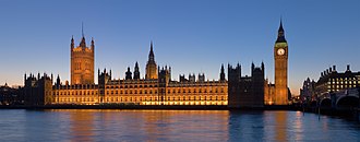
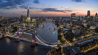
London is the capital of England and the whole United Kingdom, and is the seat of the United Kingdom's government. Edinburgh is the capital of Scotland, and is the seat of the Scottish Government and the highest courts in Scotland. The Palace of Holyroodhouse in Edinburgh is the official residence of the British monarch in Scotland. Cardiff is the capital of Wales, and is the seat of the Welsh Government. The Celtic languages began with the Hallstatt culture. The modern Welsh, Cornish, and Breton languages come from a shared ancestor language, and Latin words were borrowed into it during the Roman period. British English is spoken across the island today. It grew out of the Old English brought by Anglo-Saxon settlers from the mid 5th century. About 1.5 million people speak Scots, and about 700,000 speak Welsh, an official language in Wales. In parts of north-west Scotland, Scottish Gaelic is still widely spoken.
Christianity has been the largest religion since the Early Middle Ages, and it was first introduced under the ancient Romans. The most popular form is Anglicanism, and the Catholic Church is the second largest Christian group, with over 5 million adherents. The Church of Scotland is the third most numerous group, with around 2.1 million members, and Methodism is the fourth largest. Many other religions are practised too, including Islam, Hinduism, Sikhism, Buddhism, and Judaism. The first patron saint of Great Britain was Saint Alban, and Saint George and Saint Andrew are represented on the flags of England and Scotland.
| Rank | City-region | Built-up area | Country | Population (2011 Census) | Area (km2) | Density (people/km2) |
|---|---|---|---|---|---|---|
| 1 | London | Greater London | England | 9,787,426 | 1,737.9 | 5,630 |
| 2 | Manchester–Salford | Greater Manchester | England | 2,553,379 | 630.3 | 4,051 |
| 3 | Birmingham–Wolverhampton | West Midlands | England | 2,440,986 | 598.9 | 4,076 |
| 4 | Leeds–Bradford | West Yorkshire | England | 1,777,934 | 487.8 | 3,645 |
| 5 | Glasgow | Greater Glasgow | Scotland | 1,209,143 | 368.5 | 3,390 |
| 6 | Liverpool | Liverpool | England | 864,122 | 199.6 | 4,329 |
| 7 | Southampton–Portsmouth | South Hampshire | England | 855,569 | 192.0 | 4,455 |
| 8 | Newcastle upon Tyne–Sunderland | Tyneside | England | 774,891 | 180.5 | 4,292 |
| 9 | Nottingham | Nottingham | England | 729,977 | 176.4 | 4,139 |
| 10 | Sheffield | Sheffield | England | 685,368 | 167.5 | 4,092 |

Quiz time!
5 questions about Great Britain
How does Great Britain rank among the largest islands in the world?
Pictures
Keep exploring




This article is a child-friendly adaptation of the Wikipedia article on Great Britain, available under CC BY-SA 4.0.
Images from Wikimedia Commons. Tap any image to view credits and license.