 Safekipedia
Northwestern Switzerland
Adapted from Wikipedia · Adventurer experience
Northwestern Switzerland (German: Nordwestschweiz, French: Suisse du Nord-Ouest, Italian: Svizzera nordoccidentale) is a special area in Switzerland used by the Federal Statistical Office for counting and studying the country. This area is part of a bigger system called NUTS, which helps organize regions.
It includes three main parts of Switzerland called cantons: Basel-Stadt, Basel-Landschaft, and Aargau. These areas are known for their cities, farms, and history.
This group of areas is different from an older way of thinking about Northwestern Switzerland, which also included parts of another area called Solothurn and only some of Aargau. This shows how people can group places in different ways for different reasons.
Sub-division
Switzerland is divided into 26 cantons. These cantons are the main parts of the country. The Federal Statistical Office groups these cantons into larger areas. These larger areas are called NUTS-2 statistical regions of Switzerland. They use directions like north, south, east, and west to name these groups. Each group includes several cantons.
Geography
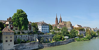
Northwestern Switzerland is in the north-western part of the country. It borders Grand Est in France to the west and Baden-Württemberg in Germany to the north. The area includes a special zone called the Basel Trinational Eurodistrict, where Switzerland, France, and Germany meet near the Rhine valley and the Alsace plain. The three countries meet in the middle of the Rhine River, just north of the Dreiländereck.
This region covers 1,958.2 km2 (756.1 sq mi) and has over 1.22 million people.
It includes the cantons of Basel-Stadt, Basel-Landschaft, and Aargau. This area is different from the traditional region also called Nordwestschweiz in German, which includes Basel-Stadt and Basel-Landschaft, some northern parts of Solothurn, and only parts of Aargau.
| S.No. | Arms | Code | Name | Established | Capital | GDP (2020) in million CHF | GDP per capita (2020) in CHF | Population (2007) | Area (km2) | Density (per km2) | Municipalities (2018) | Official languages |
|---|---|---|---|---|---|---|---|---|---|---|---|---|
| 1 |  | AG | Aargau | 1803 | Aarau | 43,590 | 63,177 | 694,072 | 1,404 | 494 | 212 | |
| 2 |  | BS | Basel-Stadt | 1501 (as Basel until 1999) | Basel | 37,168 | 189,354 | 201,156 | 37 | 5,444 | 3 | German |
| 3 |  | BL | Basel-Landschaft | 1501 (as Basel until 1999) | Liestal | 20,567 | 70,866 | 292,955 | 518 | 566 | 86 | German |
Economy
The area in northwestern Switzerland is well developed. Basel is a key economic center. Important industries here include pharmaceuticals, chemicals, and textiles. The economy grew in the early 1900s after mineral deposits were found. This helped set up many industries in Pratteln. The Hauenstein Railway linking Basel to Olten also helped the economy by connecting the area to other parts of the country. Liestal is an important town for making textiles.
Related articles


This article is a child-friendly adaptation of the Wikipedia article on Northwestern Switzerland, available under CC BY-SA 4.0.
Images from Wikimedia Commons. Tap any image to view credits and license.